top of page

TECH
ASSET INSPECTION MANAGEMENT
HIGH RESOLUTION STILL IMAGERY
STANDARD & FPV VIDEO FLIGHTS

2D MODELING PROJECT PROGRESSION
3D MODELING FOR PERCISE MEASUREMENTS
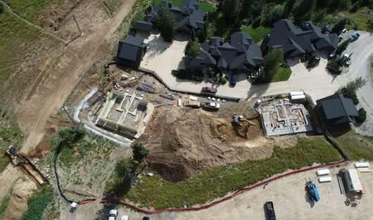
Real Time Project Progression by harnessing the latest in drone autonomous flight tools. Your project can be documented, saved and delivered to all engaged parties while never having to step onsite:
Investors - Project Leaders - Architects - Engineers
STILL IMAGERY
COST EFFECTIVE PROGRESSION UPDATES
With automated saved flight paths, drones can consistently select historical shot locations time after time to show the overall progression of the project. Imagery can be collected to monitor your project daily, weekly, or monthly.
VIDEOS
UNIQUE PERSPECTIVE TO UPDATES
FPV and Standard Videos bring your project progression to life. Stills provide a great base line while Videos animate the project progression experience.
All Videos
All Videos

Search video...

Glades 2 Update 6 8.23.23
01:59

Glades 2 Update 7 8.23.23
01:28

Glades 2 Update 3 8.23.23
01:57
2D MODELING
INTERACTIVE TOOL BAR
Map Overlays
High Resolution Stitched Imagery
Color Coded Elevations


3D MODELING
CLICK ON THE IMAGES
Use your mouse to manipulate the 3D renderings. Imagine sending Project Updates like this to Investors, Architects, Engineers and Leaders!
bottom of page


